History
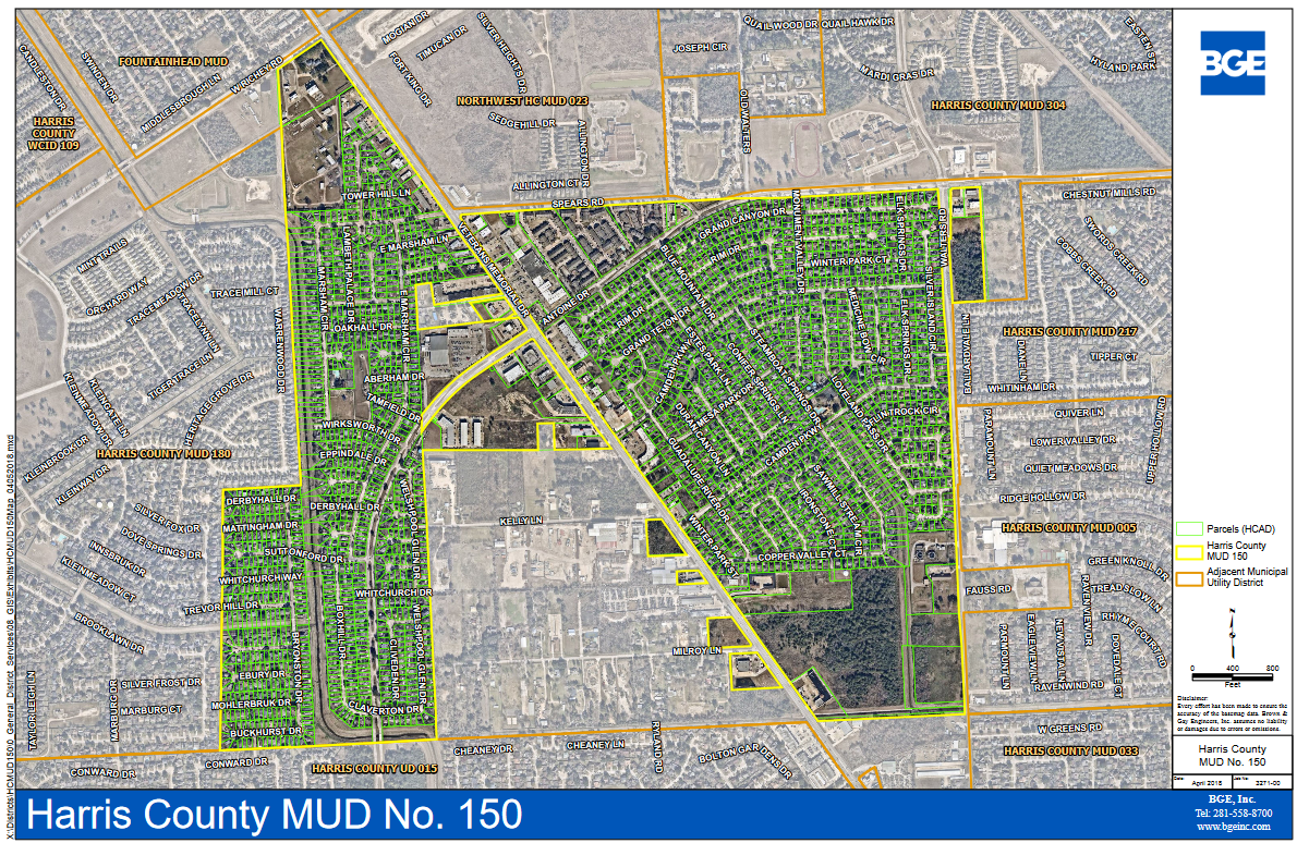
The District is a political subdivision of the State of Texas created by Order of the Texas Water Rights Commission (a predecessor to the Texas Commission on Environmental Quality) dated May 17, 1977, and operates pursuant to Chapters 49 and 54 of the Texas Water Code, as amended. The District is located entirely within Harris County, Texas, and the extraterritorial jurisdiction of the City of Houston, Texas (the “City”). The District is located approximately 15 miles north of the central business district of the City.
The District currently contains approximately 687 acres. The land within the District has been developed as single family residential use with a limited amount of commercial retail and multi-family residential development. The land that has been developed for single family residential use includes 2,150 homes situated on approximately 448 acres of land. There are currently no homes under construction and no vacant developed residential lots remaining to be built upon. Approximately $169 million of the taxable value in the District is comprised of single family residences:
Camden Park = 1,167 Lots
Northcliffe Manor = 983 Lots
TOTAL = 2,150 Lots
Northcliff Manor:
- Section 1 – 198 Lots
- Section 2 – 213 Lots*
- Section 3 – 105 Lots
- Section 4 – 78 Lots
- Section 5 – 95 Lots
- Section 6 – 294 Lots
*By recorded plat, Section 2 is for 220 lots. The lots along Welshpool Glen Drive (east side) and Whitchurch Drive (south) are divided based on deeds and follow original plat of Section 2 (not the replat). For this area, there are 39 lots by recorded plat and/or 32 lots by deed record.
Approximately 19 acres have been developed for multi-family residential use, including three (3) apartment complexes containing a total of 576 living units. Approximately $15.1 million of the taxable value in the District is comprised of multi-family apartment projects.
Commercial retail facilities have been constructed on a portion of the approximately 111 acres developed and approved for such purposes. At the present time, there are approximately 54 commercial establishments located on these sites including, but not limited to, daycare facilities, strip centers, fast food restaurants, a bank building, pharmacies, limited service hotels, grocery stores, automotive aftermarket facilities, and personal self-storage facilities.
Approximately 70 acres (owned by several different landowners) in the District are partially served by utilities and remain to be fully developed by the extension of certain water distribution and sanitary sewer collection lines and improved with building development. It is presently anticipated that such acreage will be used for commercial retail or multi-family purposes.
Approximately 38 acres in the District are not developable (District plants/facilities, road rights-of-way, or acreage owned by the homeowners associations).
The District’s water, sanitary sewer, and drainage system (the “System”) is essentially complete, based on anticipated land uses at this time. Depending on how land is developed, it may be necessary for the District to install additional water, sewer, and drainage facilities in the future.
District Map